Fray Bentos

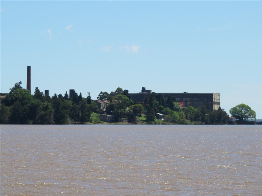
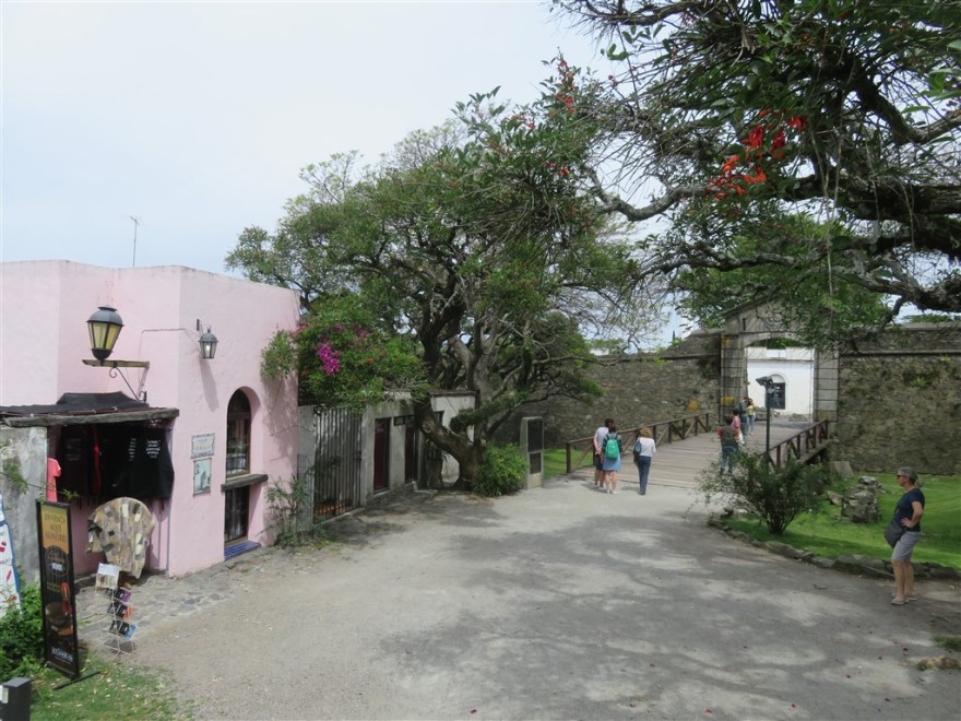
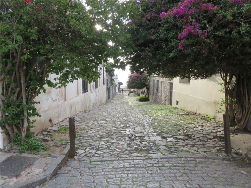
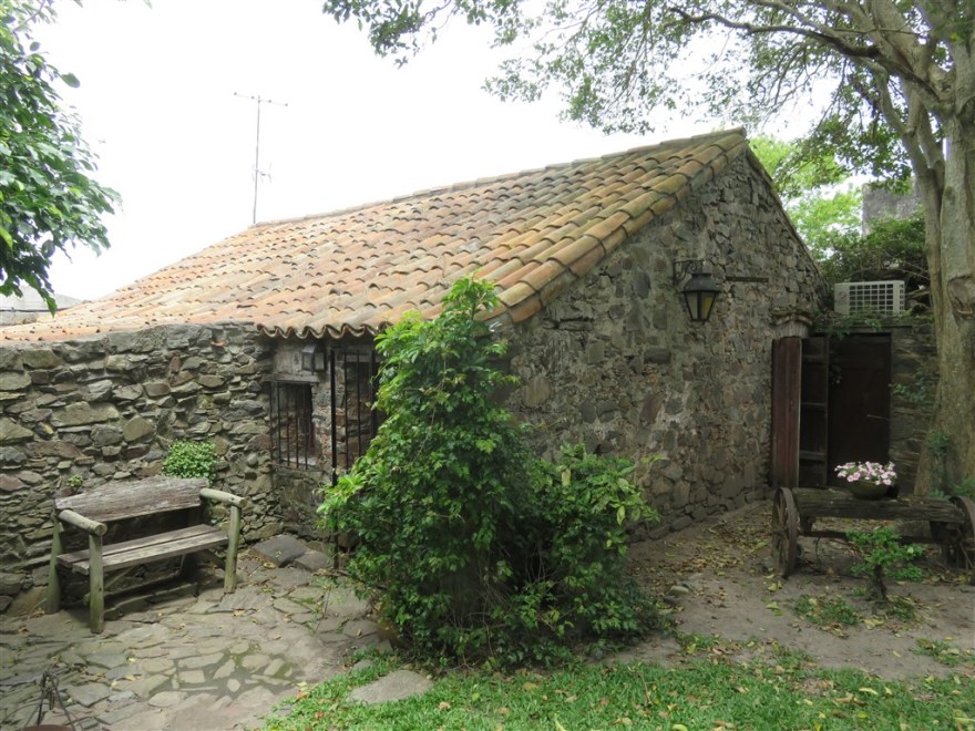
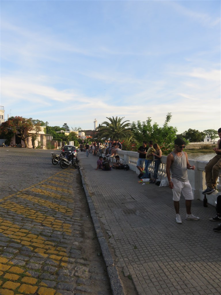
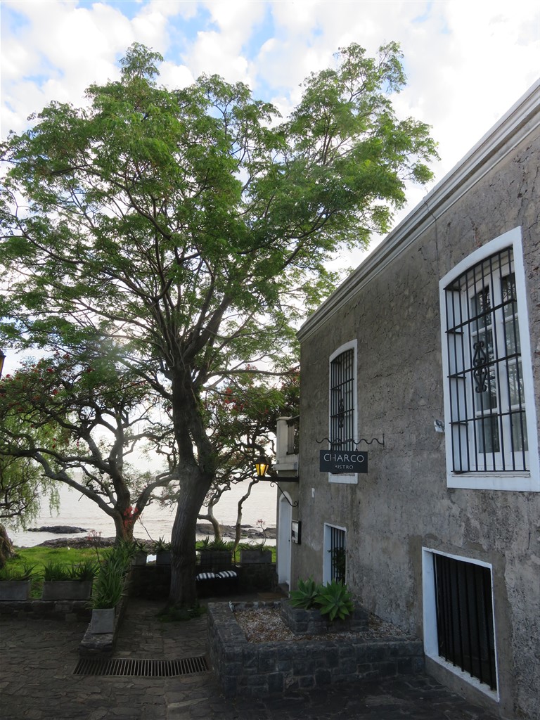
I drove north from Colonia during a heavy storm. When I arrived in the early afternoon, Fray Bentos was deserted. It looks like it has seen better times. Once the weather improved it did get some life back into it.

Advance Warning: This is a very technical post probably only of interest to those interested in agricultural/industrial history.

I came here to visit the Museum of the Industrial Revolution UNESCO world heritage site, aka the old Fray Bentos factory. (www.welcomeuruguay.com/../industrial-revolution-museum)

The town was chosen by Societé de Fray Bentos Giebert & Cie as the location for a factory to make “Liebig’s Extract of Meat” using Justus Von Liebig’s process. The region was already a big cattle producer but was only growing them to export the hides with minimal meat exports due to the lack of preservation techniques. Much of the meat was going to waste.

IMG_0116

After a successful two year test phase, the main factory started production in 1865 on the banks of Rio de la Plata.

IMG_0101

IMG_0097

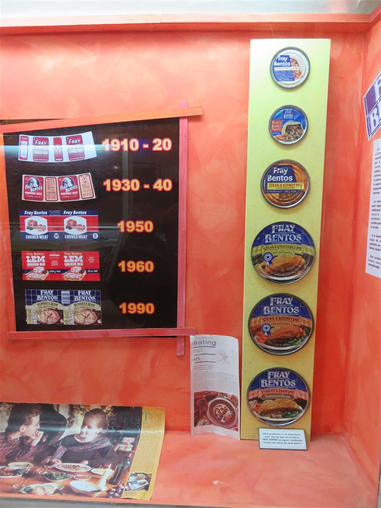
At it’s peak, the factory employed 5,000 staff (1930’s) and built its own town to house the workers. By 1875, it was producing 500 metric tonnes of the product per year. It started introducing new products, including the introduction of Fray Bentos Corned Beef in 1873 and OXO cubes in 1911.

IMG_0098

The company was managed by German staff locally, who had significant share holdings, but was mainly funded by British investment. This arrangement lead to it supplying both sides during World War I.

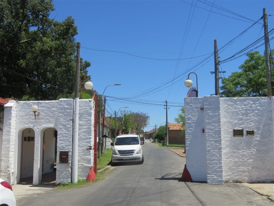
After the end of World War I, demand for their products fell and the company fell on hard times. It was acquired in 1924 and became Frigorífico Anglo del Uruguay, a solely British company. This gave its name to the town that has built up around the factory – Barrio Anglo.

The new company invested heavily in the new ammonia based refrigeration technology. This, and the introduction of steam ships which could run refrigeration units on board, meant that the company was able to start exporting beef.

Production of the original products continued and over 2 million tins of corned beef were shipped to the US army during the second world war. It didn’t supply the German army this time.

IMG_0081

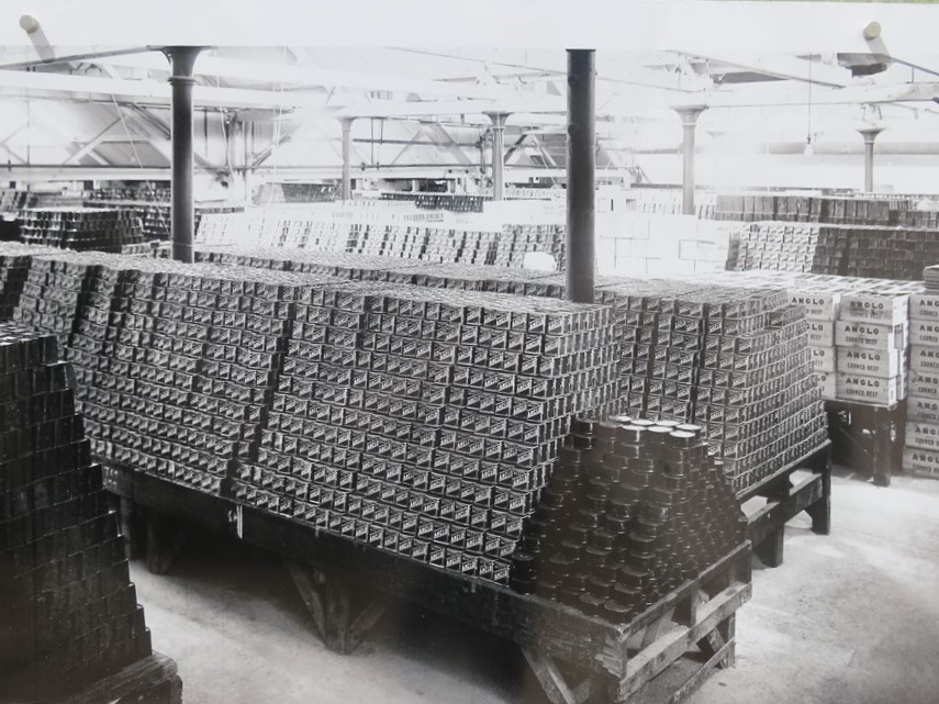
Further products were added and at one point the product range ran to several hundred items.

IMG_0077

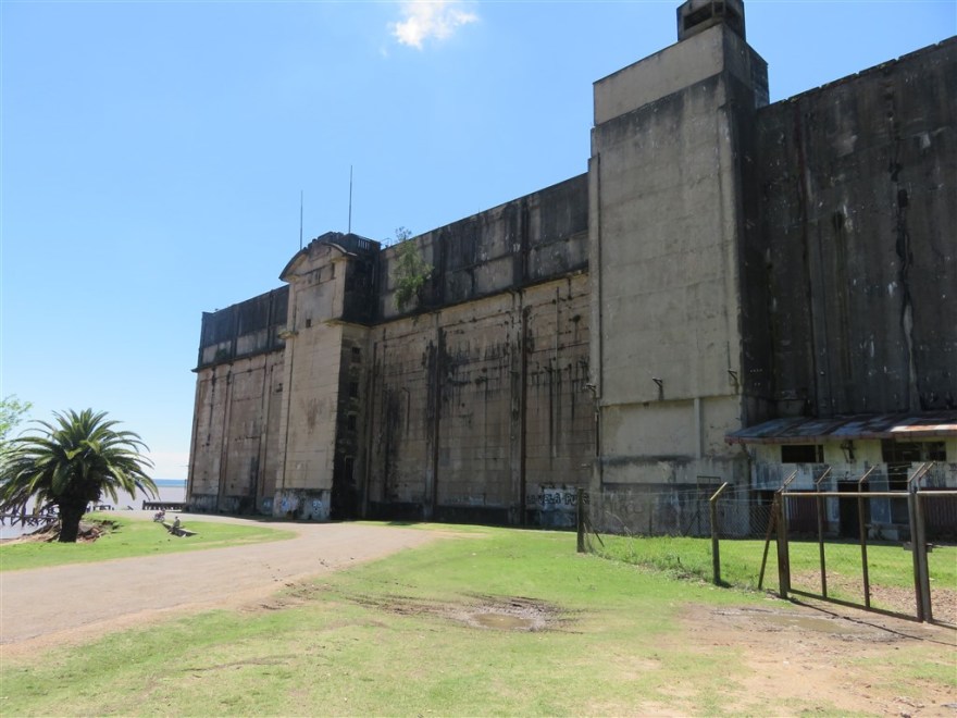
What is left of the factory is the infrastructure used from 1924 onwards. The machine room still has the generators and ammonia pumps used to run the massive refrigeration unit.

IMG_0078

The massive refrigeration unit was 100m by 40m and 5 floors high. The top 2 floors were used to keep fresh meat chilled before it was put on ships. The bottom 3 floors were used to freeze meat for future use in the traditional products. Using very early refrigeration techniques, the ammonia atmosphere in the freezers was so strong that staff were only allowed to work in there for 20 minutes before taking at least a 30 minute break.

IMG_0090

The slaughter house is also huge and could slaughter up to 1,800 animals in a 24 hour period. It was only in use for one or two days per month and mainly operated during the night shift when temperatures were cooler. Staff working in the slaughter house were the highest paid on the site and also had bigger meat allowances and better access to the company hospital.

IMG_0112

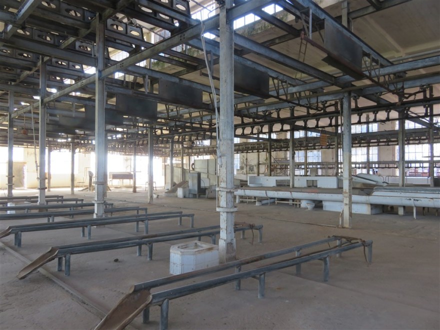
The processing plant for the original meat extract is still intact.

One of the compressors in that plant room had a rather familiar name on it.

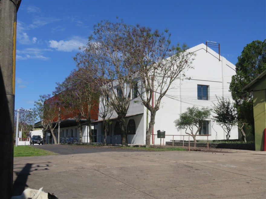
The factory consisted of 36 different buildings.

Many of the walkways are made of plate steel. This is because the early sailing ships used it as ballast on their outward trip from Europe and then dumped it once loaded with meat products. Later on, ships used coal as ballast on their outward trips. This was then used in the boilers that powered the machine room all other plant in the factory.

IMG_0086

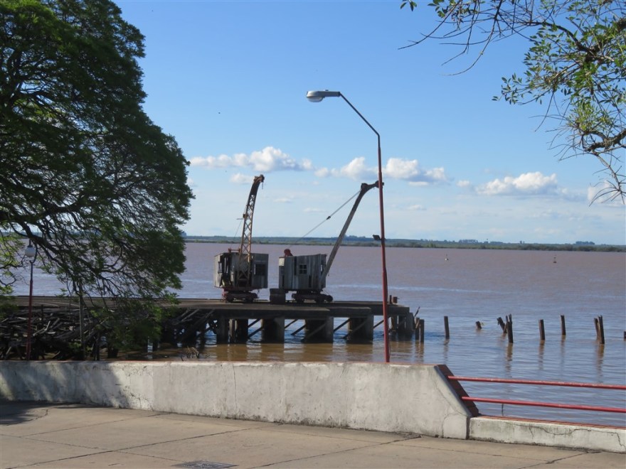
The river has already reclaimed much of the piers that were used for loading ships.

IMG_0115

The factory office is best preserved part of the factory. The Anglo company continued until they decided to shut the factory in 1968 due to falling demand and increased competition. During the period from 1924 to 1968 the factory became self sufficient in its requirements for maintaining the 1920’s equipment. This was mainly due to their remote location and the cost of importing spare parts. They used every part of the animals slaughtered at the plant and even used animal hair to make their own paint brushes.

When Anglo announced the closure of the plant in 1968, the Uruguay government stepped in and bought the plant as it stood and significant amounts of surrounding land for US$1,000,000. The only thing they didn’t buy was the Fray Bentos brand name. This has since been sold on several times and is currently owned by Baxter’s Soup in Scotland. The Government continued to run the factory until 1979 when it admitted defeat and finally closed down the business. At the same time it declared the site a national monument/museum which ensured everything was moth balled. The office was continued to administer the museum until it was made a UNESCO world heritage site in 2015.

IMG_0085

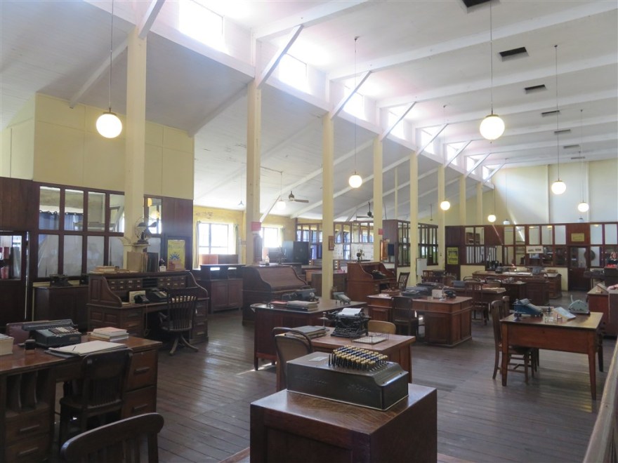
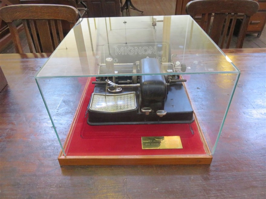
There are two particular items of interest in the office. The first is one of the very first type writers which dates back to 1903. Rather than use the better know keyboard, this early model required the user to point to the letter required and then press either a capital or lower case button to print the letter.

IMG_0087

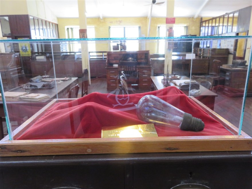
The other is the first ever light bulb used in the plant which dates back to 1883. At this time the factory was very technologically advanced and used electricity 4 years before it became available in Montevideo. The generators used at that time were much smaller than those seen in the 1920’s machine room. However, they supplied lighting for all of the plant and powered some machines. In the evenings, when less power was required, output was diverted for use in the factory houses.

IMG_0088

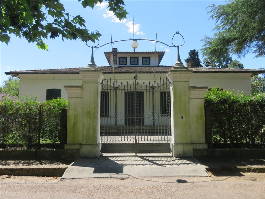
The general manager’s house is also part of the museum but only available to tour on Thursday mornings. I visited on a Wednesday.

IMG_0103

Although UNESCO provide the prestige and the publicity of world heritage site status, they don provide any funding. The site trustees have looked for other sources of income and recently some of the unused buildings have been converted into a campus for the Technical University of Uruguay – UTEC.

IMG_0110

The surrounding land is used as common park land. Many of the locals keep their horses there.

IMG_0092

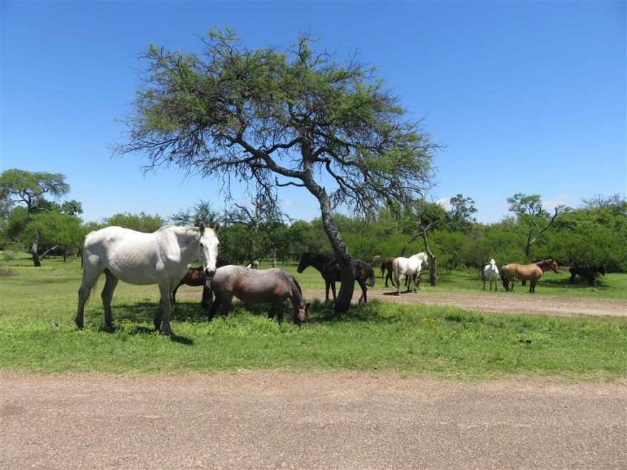
They have also built a race track.

IMG_0104

It also has some nice beaches.

IMG_0094

After Fray Bentos, I had originally intended to drive north to Salto. There I planned to visit the hot springs and hydro electric plant. Upon advice from my work colleagues in Buenos Aires, I decided to head south to the beach resort of Punta del Este instead. This gave me an excuse to splash out on a fancy hotel for a couple of nights.


Colonia del Sacramento

Colonia del Sacramento, in Uruguay, is 50km east of Buenos Aires across the Rio de la Plata (River Plate). I took a high speed ferry and the crossing took an hour. I checked into El Viajero Posada B&B (elviajerohostels.com/../el-viajero-posada-bb#) which is located between the port and the old town. The B&B is run by a hostel group and offers great value with very comfortable rooms.

IMG_0069

Colonia is one of the oldest towns in Uruguay with quiet, tree lined streets.

IMG_0067

The historic district is a UNESCO world heritage site. Parts of the old town have been restored, but only where they have the original plans/documentation to ensure authenticity. The town gate was rebuilt using its original stone which had been used to fill in the moat in front of it.

IMG_0027

IMG_0028

Many of the old streets still have their original paving.

IMG_0050

IMG_0014

The old town switched between the Spanish and Portuguese eight times between 1680 and 1822 (also 6 years of Brazilian rule). This has resulted in the mixed Spanish and Portuguese architecture. The house on the left in the picture below is Portuguese and the one on the right of Spanish design.

IMG_0060

This also applies to the roads. The paving on the left in the picture below is Portuguese and Spanish on the right. Both the Spanish style houses and paving appeared to have aged better.

IMG_0054

Very little in the old town has changed.

The Lighthouse is one of the most modern buildings in the old town. Unfortunately, I wasn’t able to go up it as I still had a very bad knee from a trip up the Palacio Barolo in Buenos Aires a couple of days before (see future 2nd post on Buenos Aires).

IMG_0045

A local artist has restored one of the Portuguese houses.

IMG_0033

IMG_0030

IMG_0031

The Roman Catholic parish is one of the oldest in Uruguay. The current church (Basílica del Santísimo Sacramento) dates back to 1810. It has been restored several times since due to storms and fires.

IMG_0041

IMG_0037

The old town is located on a rocky peninsula.

IMG_0059

IMG_0021

There are several old vehicles scattered around the town. This one is used by a local restaurant as an extra table.

IMG_0038

Not all of the buildings have been looked after so well.

IMG_0048

The old port is a popular meeting point at sunset.

IMG_0020

IMG_0019

The town becomes even prettier after dark.

IMG_0025

IMG_0022

I found two good places to eat. The first was the Bistro in the Charco Hotel (www.charcohotel.com). The meal was excellent and the hotel rooms looked very nice too.

IMG_0043

IMG_0044

IMG_0063

The other was Don Joaquin Pizza just outside the old town. (www.facebook.com/pg/donjoaquinartesanalpizza/..). Voted the best pizza in Uruguay by TripAdvisor.

IMG_0068

After a couple of very pleasant days in Colonia, I picked up a rental car and headed north to Fray Bentos. On my way out of the town I passed the old bull ring. It was built as part of an ambitious tourist complex in 1910. Unfortunately, it only ever hosted eight fights before bull fighting was prohibited by the national government in 1912. It has been unused ever since and is now in danger of collapsing.

IMG_0071


Iguazu Falls

We flew from Buenos Aires to Iguazu on 27th October. Iguazu is in north east Argentina on the border of Brazil and Paraguay. There was a severe storm in Iguazu as we tried to land and the pilot had to abandon the landing and fly south 150km to Posadas. The plane sat on the ground for about 45 minutes and then set off to Iguazu again. This time we were able to land.

We had come to visit the Iguazu Falls from both the Argentinean and Brazilian sides. On our first day we went to the Parque Nacional Iguazu on the Argentinean side. (www.parquesnacionales.gob.ar/../pn-iguazu)

You take a small train from the entrance of the park to the falls. It is about 6km to the end of the line.

IMG_0209

Our first view of the falls was of the of the Devil’s Throat which is the largest waterfall in the park at 90m in height. Due to the previous day’s storm, there was about 3 or 4 times more water going over the falls than normal for this time of year.

IMG_0213

You can get right to the edge of the waterfalls.

IMG_0226

However, having enjoyed seeing very few other tourists in Patagonia (except up the last section of Torres del Paine!), Iguazu was very different and it was packed. I would hate to be here in peak season.

IMG_0225

Despite the crowds of people, we saw quite a lot of wildlife.  This is a plush crested jay, a member of the crow family.

IMG_0240

These are Coatis (aka Coati-Mundis), members of the raccoon family. We saw them all over the park scavenging from the tourists.

IMG_0241

There were also lots of butterflies.

IMG_0247

IMG_1437

We took a boat trip up the Iguazu river to the base of the falls. We had a chance to take some pictures before getting closer to the falls which was extremely noisy and wet.

IMG_0265

We travelled in powerful motor boats which had to navigate up the rapids to get to the falls.

IMG_0266

This picture is of another group in a similar boat taken from the top of the falls.

IMG_0303

After the boat trip, we went around the upper walkway of the other falls.

IMG_0277

IMG_0282

IMG_0300


We also saw more wildlife up here as well. This is a Vulture sunning itself.

IMG_0270

IMG_0273

A lizard.

IMG_0274

And Brown Capuchin monkeys.

IMG_0318

The following day we crossed the border to see the falls from the Brazilian side. Although Brazil only has about one third of the riverside that Argentina has, their park – Parque Nacional do Iguacu (www.icmbio.gov.br/parnaiguacu) – seemed just a busy. From this side you get a much more panoramic view.

IMG_0328

However, you can get very close to the bottom of the falls on this side.

IMG_0336

IMG_0335

We stayed a very non descript 3 star hotel on the Argentinean side. However, if you prefer something more up market, I suggest you try the Hotel Das Cataratas (www.belmond.com/../belmond-hotel-das-cataratas/..) on the Brazilian side.

IMG_1446

We had a great time at the Iguazu Falls. If I had not been on an organised tour, with a fixed schedule, I would have liked to have visited the ITAIPU hydro electric dam (www.itaipu.gov.br/en). The dam was constructed at the site of the Seven Falls on the Parana River – about 50km upstream of the Iguazu Falls. Theses Falls were even bigger than the Iguazu Falls. When the project started in the 1970’s, it was seen as ego boosting project by the military government of the time. However, with sustainable power now of more interest, it has proved a good investment. It supplies 20% of the total power used in Brazil and 94% of the power used in Paraguay.

Itaipu_Décembre_2007_-_Vue_Générale[1]

The following day we flew back to Buenos Aires without incident. This was the end of my Explore trip. I spent another day in Buenos Aires before setting off to Uruguay.

El Chalten

After a couple of days in the south of Los Glaciares National Park, we to headed up to El Chalten in the north of the park, driving around Lake Viedma to get there.

IMG_0192

On the way we stopped at Hotel La Leona (www.hoteldecampolaleona.com.ar). There has been a roadhouse here since the 1890’s next to the raft service that allowed early settlers to cross the river on the way back from the Atlantic coast. Its main claim to fame is that Butch Cassidy, Sundance Kid and his wife Ethel Place stayed here after robbing a bank in Rio Gallegos.

IMG_0196

El Chalten was built in 1985 to help secure the disputed border with Chile and support the growing tourist market. Today, its sole reason for existence is tourism.

IMG_1429

It is known as the trekking capital of Argentina. One of the main attractions is Mount Fitzroy, one of the most challenging mountains to climb.

IMG_0204

Like other towns that we visited in Patagonia, it has a lot of very small houses.

Most of our group set off on another challenging hike up to the base of Mount Fitz Roy. Having developed a bit of a knee problem after my trek in Torres del Paine, I opted to spend the day in the town.

It didn’t take long to look around the whole town and I spent most of the day in a lovely coffee shop called Mathilda (www.facebook.com/mathilda.elchalten). I used the time plan ahead for the next part of my South America trip.

IMG_0199

In the evening the group had our last meal together.

IMG_0207

The next day (26th October) we flew back to Buenos Aires where some of the group set off home and the rest of us headed off for an extension to the Explore trip in Iguazu Falls.

El Calafate

We left Torres Del Paine National Park on 22nd October and headed back to Argentina. Luckily the border was quiet and we got across quickly. Our orange bus pictured below on the Chilean side of the border. Once through this point we drove about 5km to the Argentinean border post and completed border crossing formalities again.

IMG_1416

We stopped outside this Argentinean Estancia to change buses.

IMG_1418

Then more of the Patagonian Steppe.

IMG_0168

This time we saw a grey fox.

IMG_0166

The main purpose of coming to El Calafate was to visit the Perito Moreno Glacier in the Parque Nacional Los Glaciares (www.parquesnacionales.gob.ar/../pn-los-glaciares/). We took a boat out to the front of the south side of the glacier.

IMG_0174

IMG_0173

Then we walked along the impressive viewing platforms along the coast.

IMG_0177

The ice at the bottom of the glacier can be very dirty having scraped along the ground for many years. Unlike many of the other glaciers, this one is not retreating and has actually grown over the last century. This is due to the high volume of snow landing at the top of the glacier. It is one of the fastest moving glaciers.

IMG_0178

This Crested Caracara has become used to the visitors.

IMG_0181

The walkways provide excelleny views of the north side of the glacier as well.

IMG_0188

There are about 4km of walkways around the glacier.

IMG_0190

From El Calafate, we headed to EL Chalten – the final stop on our Patagonian trip.

Torres del Paine

We headed north from Punta Arenas to the Torres del Paine national park (www.parquetorresdelpaine.cl) droving across the vast Patagonian Steppe.

IMG_0095

It is the 8th largest desert in the world, occupying 673,000 square kilometres. We saw some varied wildlife along the way:

IMG_0092

Chilean Flamingos

IMG_0099

Black-necked swans

IMG_0094

Darwin’s Rhea (aka Lesser Rhea) and lost of sheep (not pictured)

Just outside the park we stopped at the Mylodon Cave Natural Monument. In 1895, one of the first settlers found an animal hide with thick hair. It belonged to a Mylodon, now extinct, which was a relative of the sloth and lived in this area over 10,000 years ago.


We checked into the Hotel del Paine (www.hoteldelpaine.com), also just outside the national park.

IMG_0113

It had the best view from the hotel window so far on this trip.

IMG_0116

It got even better at dawn.

IMG_0156

The scenery on our first day in the national park was stunning.

IMG_0132

IMG_0128

Walking in the park we came very close to several different animals. They are protected in the park and, with no predators, are much more tolerant of people around them. We saw many Guanaco

IMG_0126

and some Rheas.

IMG_0121

We also saw some ancient cliff paintings.

IMG_0127

We also took a boat ride up the Serrano river to see the Serrano Glacier in the Bernardo O’Higgins National Park (named after the first head of state of the Republic of Chile).

IMG_0154

IMG_0150

IMG_0139

We trekked along the side of the valley for a closer look at the glacier.

IMG_0146

The glacier is moving continually and breaking off into the river in front of it.

IMG_0143

On our second day, we took on the most popular trek in the park is up to Base Las Torres (the lookout to the towers). It is 11km up to the lookout rising 775m (2,540 feet). Start at just over 100m above sea level, the first part of the trek is up steep mountain side.

IMG_1403

This brings you to the entrance to the valley known as the wind pass. Luckily there was very little wind when we went through.

IMG_1409

You then descend into Ascencio Valley (named after a horse thief)

IMG_1408

The next section follows the river through the woodland up the valley floor.

IMG_1414

The final 800m is the steepest, ascending one third of the total height climbed.

IMG_1415

We finally arrived at the lookout.

IMG_0161

IMG_0163

The weather was starting to turn so there was just time for a quick lunch before starting our descent.

IMG_0162

I never noticed this in the woods on the way up.

IMG_0165

It took four and a half hours to ascend and just over 3 hours to descend.

The next day we headed north to Calafate.


Punta Arenas

On 18th October we left Ushuaia and headed to Punta Arenas in Chile. The 10 hour road trip involved crossing the Magellan Straits by ferry.

IMG_0070

We arrived in the late afternoon for a one night stopover before heading north the following day. We stayed at the Hotel Savoy which didn’t quite live up to the standards of its London namesake.

IMG_0087

Punta Arenas is Chile’s southern most city and was originally founded as a small penal colony in 1848. It grew in importance as the maritime traffic through the Magellan Straits increased and then boomed in the early part of the 20th century with the introduction of sheep farming. Many of the buildings from that time still remain. Most were designed in Europe and shipped out partially complete.

IMG_0086

The main square has a statue of Ferdinand Magellan, the Portuguese explorer who discovered, and named, the Magellan straits in 1520.

IMG_0084

It is considered lucky to touch the toe of the one of indigenous people that adorn the bottom level of the statue.

IMG_0085

We had a great meal at La Luna restaurant (www.laluna.cl/)


Ushuaia

Ushuaia is the capital of Tierra del Fuego province in Argentina and the southern most city in the world. We arrived on an early flight on 16th Oct and were greeted with a rainbow on our arrival.

IMG_0093

We had the morning to look around the town but didn’t see much as it was public holiday – Columbus Day.

IMG_0094

IMG_0096

IMG_0001

Ushuaia is a big producer, and consumer, of lamb.

IMG_0095

In the afternoon we took a boat out into the Beagle Channel and saw some of the local wildlife.

IMG_0003

First off was an island of nesting Cormorants.

IMG_0005

IMG_0025

Followed by and an island they had abandoned leaving their old nests.

IMG_0009

Next were the Sea Lions.

IMG_0012

IMG_0023

We landed on one of the small islands in the channel and had a look around.

IMG_0031

IMG_0030

Although it is very close to the port of Ushuaia, the weather is so changeable that it has a refuge for anyone caught on the island when the weather is too bad to return to port. I’m not sure how much weather the refuge could stand.

IMG_0033

The following day we hiked in the Tierra del Fuego National Park.

IMG_0036

IMG_0037

The Pan American highway ends in the park, 17,848 Km from its start in Alaska.

IMG_0038

We saw quite a few of these signs around…

IMG_0039

and pairs of Magellan geese.

IMG_0044

Beavers were introduced from Canada about 70 years ago (supposedly to provide fur for Eva Peron’s coats) and have done tremendous damage to the woodlands as they have no natural predators.

IMG_0041

Later we visited the Harberton Estancia (www.estanciaharberton.com) about an hour west of Ushuaia. Established in 1886, it is the oldest farm in the Argentinian side of Tierra del Fuego and still run by the 4th generation of the original family. The main house was designed and constructed in the UK and then shipped out in parts – an early form of flat pack construction. The late wife of the current owner was a renowned expert in the local marine life, hence the whale jaw over the entrance.

IMG_0048

This extremely windy country, as can be seen by some of the trees on the farm.

IMG_0047

The farm no longer rears livestock after a particularly severe winter a few years ago that 60% of the animals did not survive. It has now diversified into the tourism business with the residents of Isla Martillo, a small island close to the far,. It is home to two groups of penguins. The first group is 40 pairs of Gentoo penguins who had just started nesting.

IMG_0052

It is also home to approximately 4,000 Magellanic penguins who were also sitting on eggs in shallow earth burrows.

IMG_0059

IMG_0058

IMG_0061

IMG_0055

Amongst the penguins, we saw a vulture with its prey (not a penguin).

IMG_0054

The following day we set off on a 10 hour bus and ferry trip to the Chilean side of Tierra de Fuego.

Buenos Aires

After an enjoyable summer spent at home in Ealing working on the house (and recovering from a perforated ulcer), I have recommenced my travels. This time my first stop is in Buenos Aires.

IMG_0045

Arrived here on Friday 13th October with my friend Jane from Ealing. We were due to join a 17 day organised tour of Patagonia and the Iguazu Falls. We arrived a day early in order to see more of the city. We started with the opera house – Teatro Colon (www.teatrocolon.org.ar/en/home).

IMG_0026

The theatre is acoustically considered to be one of the top five opera houses in the world.

Colon-interior-escenario-TM

La_cúpula

Buenos_Aires_-_San_Nicolás_-_Teatro_Colón

IMG_0016

IMG_0013

Following on with the theatrical theme, we visited El Ateneo Grand Splendid – a theatre that has been converted to a bookshop. It has been voted the second most beautiful bookshop in the world by The Guardian.

IMG_0030

IMG_0029

IMG_0028

After coffee in the café on the stage, we went for lunch in one of Buenos Aires’ oldest cafes – Café Tortoni (www.cafetortoni.com.ar/en/).

IMG_0032

IMG_0035

After lunch we headed down to Plaza de Mayo, which is in front of the Pink House – the president’s office.

IMG_0046

We also had a quick look in the very Roman looking Cathedral on the same square.

IMG_0043

IMG_0041

IMG_0039

Our next stop was Port Madero, the restored dock yards. On our way we got lost in the very impressive Kirchner Cultural Centre.

IMG_0048

The port is now a marina with shops and restaurants occupying the old warehouses.

IMG_0053

That evening we ate steak at Cabana Las Lilas (www.restaurantlaslilas.com.ar/EN/) in the port.

IMG_0051

The next day we started out in Plaza San Martin, one of parks in the city centre.

IMG_0057

Nearby is the Torre Monumental, a present to the city from the local English community to celebrate the centenary of the May 1810 revolution. It was originally called Torre des los Ingleses (Tower of the English) but was renamed Torre Monumental in 1982 after the Falklands war.

IMG_0055.jpg

We continued our walk around the city centre streets.

IMG_0059

We passed the old Harrods store.  Originally established in 1914 as the only overseas branch of the London store, it was sold to local owners in 1922. It closed in 1998 over legal disputes between the local owners and Mohammed Al-Fayed. There are plans to reopen it, watch this space – www.harrodsbuenosaires.com.ar

IMG_1390

We tried out some interesting seats which were not as comfortable as they look.

IMG_0060

and enjoyed the café culture.

IMG_0061

Buenos Aires has a rather unique cemetery which has become the resting place of the rich and famous.

IMG_0065

IMG_0072

IMG_0071

The remains of Eva Peron have recently been returned to the cemetery after a very sad and complicated past. She is now buried in the tomb of her brother in law’s family.

IMG_0068

IMG_0069

After the cemetery, we went on to the much more colourful district of La Boca.

Our final stop was the market in San Telmo – the oldest part of the city.

IMG_0081

IMG_0079

IMG_0077

We departed early on the 16th Oct to catch the 4.30am flight to Ushuaia in Patagonia.


Bargemon

After returning from my big trip I settled back into life in Ealing working on my house refurbishment. Tom and Tamara Parker are helping with this (to be honest they are doing all the work) and they had planned a trip to Bargemon in the south of France to help Tamara’s brother prepare his holiday home for the summer season. I offered to go along and help as well.

I flew into Nice on 14th June and picked up a hire car for the hour’s drive west. The village is located in the hills north of St Tropez.

IMG_1203

Toby and Amelia’s apartment is located on the edge of the village in Bargemon Chateau. A short walk past one of the many fountains to the village square.

IMG_1189

IMG_1195

IMG_1197

IMG_1190

The village has a weekly market on a Thursday.

IMG_1202

Village life is very sedate.

IMG_1207

IMG_1205

IMG_1206

Once the work was complete we spent some time by the pool which is shared by all the apartments in the Chateau.

IMG_1208

My Uncle placing his breakfast order

IMG_1185

and relaxing by the pool.

IMG_1209

Family meal on the last night.

IMG_1214

If you are interested in renting The Keep at Bargemon Chateau, have a look at www.bargemonchateau.com