Queenstown

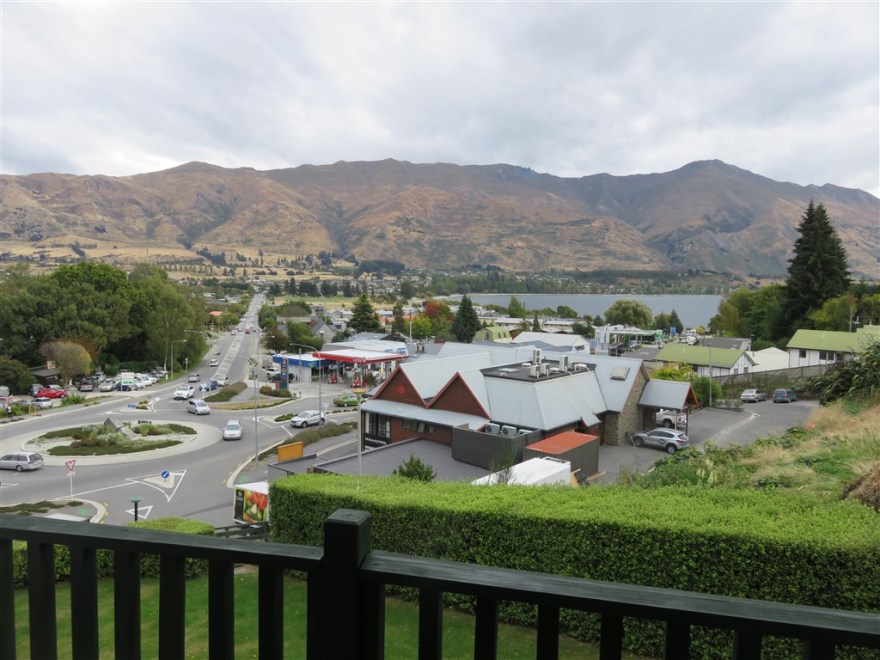
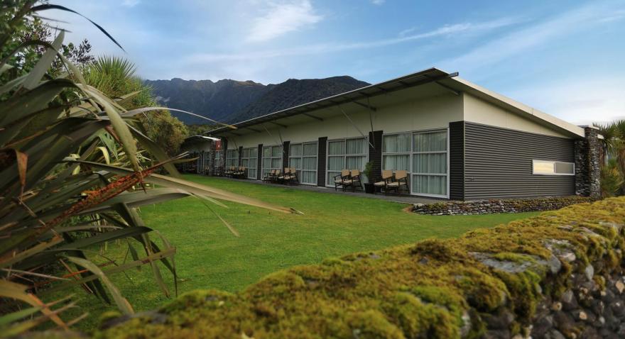
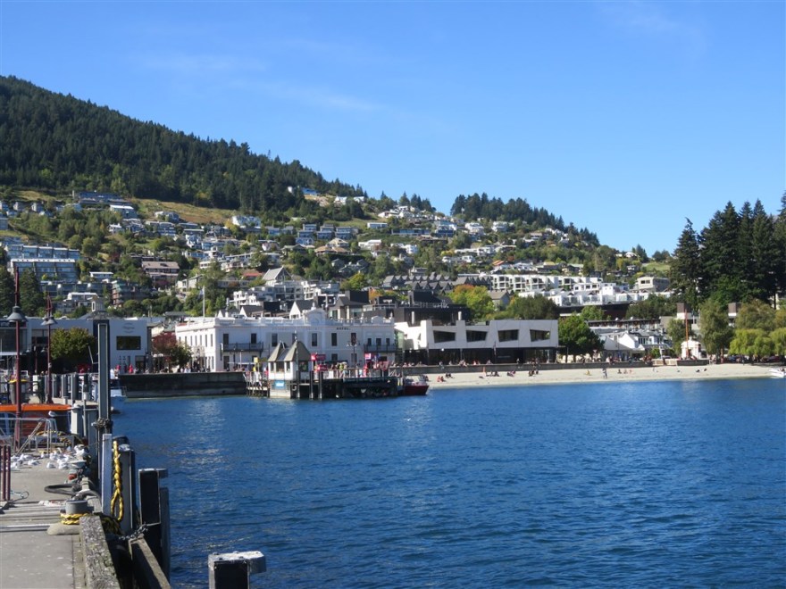
We arrived in Queenstown on 23rd March for our official free day in the Exodus schedule. We checked into the Aspen Hotel, which I think  had the best view from the restaurant on this trip.

aspen

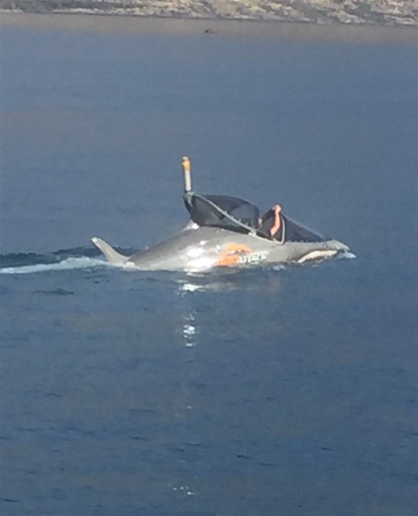
Queenstown is the extreme activity centre of New Zealand. In addition to the usual bungee jumping, jetboating and white water rafting you can go for a ride in a dolphin shaped, submersible craft.

IMG_0995
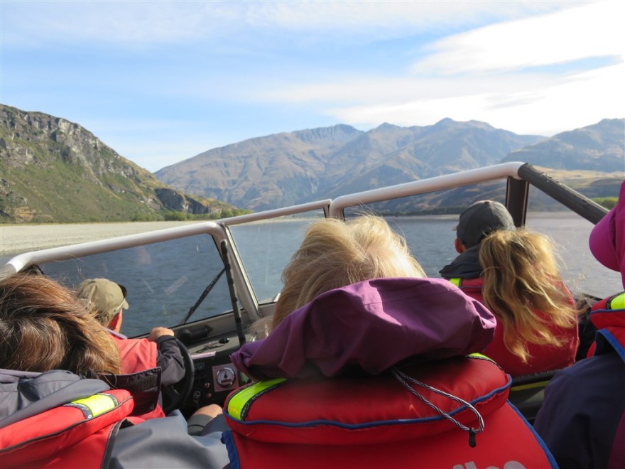
Or do this (what ever it is called).


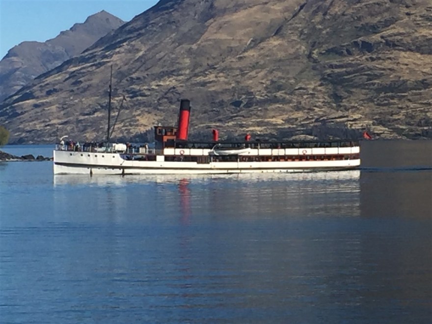
or opt for a more sedate steam cruise.

IMG_0998

With this exhaustive list of activities to chose from, Jan, Niamh and I chose to sit around do nothing in particular for the day.

We started off with a coffee in the excellent Vudu Café (www.vudu.co.nz) and sat there for an hour or so.

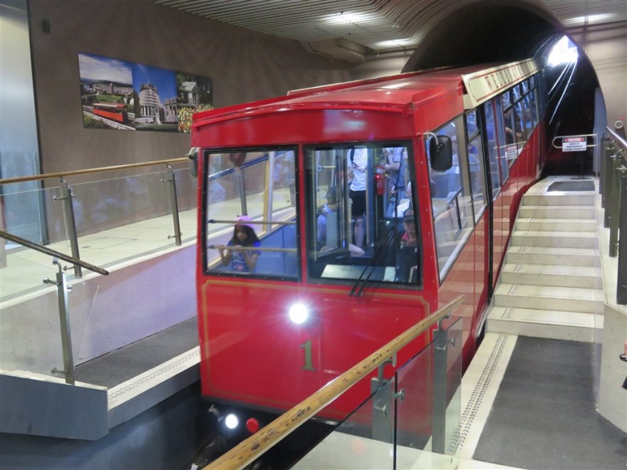
We then took a trip up on the Gondola which takes you up 450m to the top of Bob’s Peak.

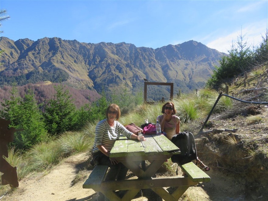
We walked around the Skyline Walk at the top of the peak and found a picnic table with a view. We spent a long time watching the Paragliders start their decent from just behind where we were sitting. We were hoping to see our travelling companion Peter but we found out later he had jumped off a different mountain.

IMG_0367

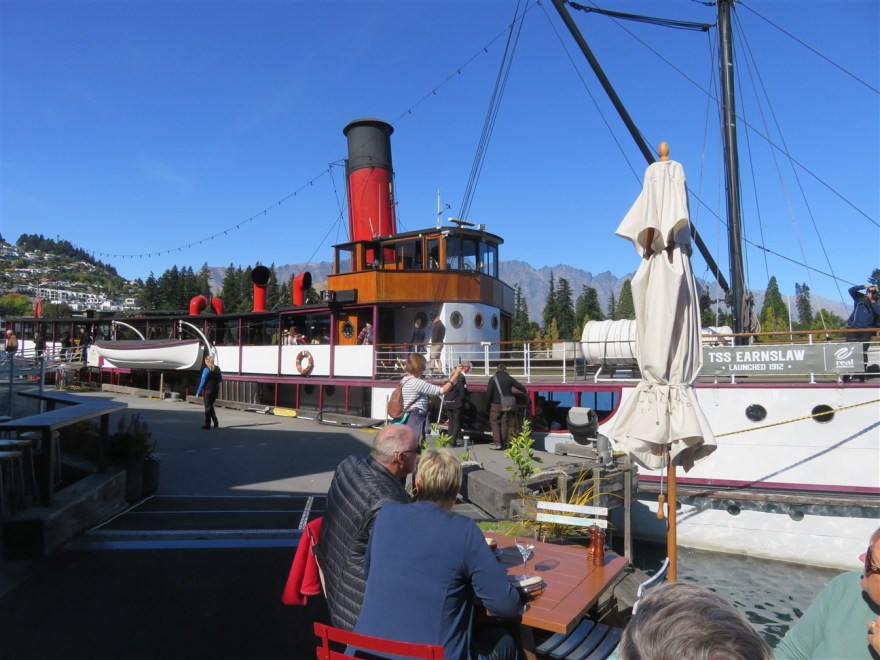
We then returned down to the town centre and found a pub on the lake side with tables outside by the steam boat.

IMG_0375

After a day of not doing much at all we set off to look for the bus back to the hotel (to avoid the walk up the virtually vertical hill). We were having problems finding the bus stop when a nice Chinese lady stopped to see if she could help. We explained we were looking for the bus up to the hotel and she offered to give us a lift in her car. On the way up we passed several of our fellow travellers sweating their way up the hill. A very satisfactory day.

IMG_0373

(Thanks to Vudu Café and Aspen Hotel for use of their photos – you can tell which ones they are as they are much better that my basic point and click efforts)


Wanaka

We arrived in Wanaka on 21st March for a 2 night stay at the Wanaka Heights Motel. It won the prize for the best view out of the window so far.

IMG_0333


And even more so later that evening.

IMG_0336

Our prime reason for visiting Wanaka was to go Jetboating on the Matukituki River in the Mount Aspiring National Park (www.doc.govt.nz/../mount-aspiring-national-park). We got kitted out in or waterproofs and set off up the river at about 65 Kph.

IMG_0338

The jetboat, which can operate in as little as 6 inches of water, was able to take us up to the base of Mount Aspiring where we could see yet more glaciers (At this point in the trip we had seen so many amazing mountains, volcanos, waterfalls and glaciers that we were starting to get a little blasé about seeing any more).

IMG_0341

We stopped off on the way up the valley for a break and a walk through a birch forest.

After lunch we set for a hike up Rocky Mountain. We started off walking around Diamond Lake.

IMG_0354

We got more impressive views from the lookout at the top.

IMG_0356

IMG_0359

IMG_0361

After another night in our Motel with great views we set off for Queenstown.

Franz Joseph and Fox Glaciers

Another day, another national park! This time it is the Westland Tai Poutini National Park (www.doc.govt.nz/../westland-tai-poutini-national-park) about half way down the west cost of New Zealand’s south island. Our first hike is to the Franz Joseph Glacier and I see they have added a new sign – very up to date on their technology.

IMG_0303

The glacier goes through cycles of advancing and retreating. It has been retreating since 2008. When advancing, it can advance by up to 70 cm per day – a phenomenal distance by glacial standards. We set off up the valley on a fairly cloudy day and passed several impressive water falls.

The glacier itself was only partially visible due to the low clouds. It is about 12Km long.

IMG_0310

In the afternoon we walked around Lake Matheson which is supposed to have excellent reflective qualities due to the dark brown colour of the water (this is caused by all the organic matter from the forest floor washing into the lake.) On a good day you can see the reflections of the Southern Alps in the lake. Due to the low cloud we had to make do with the reflections of the surrounding forest.

IMG_0318

IMG_0317

We spent the night in the Westhaven Motel in Fox Glacier township.

westhaven

The following day we set off for Fox Glacier. Like Franz Joseph, you approach it from the valley on the coast side.

IMG_0319

IMG_0322

The viewing platform is about 450m from the glacier. Overhead we saw several helicopters taking people for walks on the top of the glacier.

IMG_0320

After our hike to the glacier, we set off south to Wanaka and had to stop along the way for a road crew clearing loose rocks from the cliffs on the roadside.

IMG_0329

IMG_0328

Punakaiki

Our next destination was Punakaiki in the Paparoa National Park (www.doc.govt.nz/parks-and-recreation/places-to-go/west-coast/places/paparoa-national-park) on the west coast of the south island. It is a relatively new – only established in 1987.

We checked into the Punakaiki Tavern which was located on the Tasman Sea coast.

IMG_0299

Our first hike was along the Pororari River Track which included crossing a wobbly suspension bridge – the first of several on this trip.

IMG_0277

After a walk through the forest, we joined the river side path.

After this short walk we visited the Punakaiki Pancake Rocks and Blowholes. The Pancake Rocks are eroded limestone rocks that look like stacks of pancakes.

The downside of the excellent weather was that the blow holes were not active.

IMG_0298

After our brief one night stay in Punakaiki on 19th March, we set off south in search of glaciers.

Nelson and Motoeka

The ferry docked in Picton, on the South Island, at just after midday on 17th March. We set off west towards the Abel Tasmin National Park – New Zealand’s smallest national park.

On route we stopped at Nelson which is the oldest city on the South island. It was first established in 1841 and proclaimed a city by Royal Charter in 1858. Nelson claims to be the geographical centre of New Zealand with the actual centre point conveniently located on top of Botanical Hill.

Which has great views over the city.

IMG_0980

If you dig deeper, it turns out that the engineer assigned to the first official survey of the country (John Spence Browning) was the Chief Surveyor for Nelson and he chose the top of the hill as the base point for his survey. It wasn’t until 1962 that the correct centre point was established south west of Nelson.

Nelson also claims to be the location of the first rugby game in New Zealand. This is true and the game was introduced by the son of one of the City’s founders who has been educated in England. The match was played on 14th Mat 1870 on the Botanical Reserve

The ground was being prepared for a cricket match when we visited.

We spent the night in Motoeka and the following morning we headed off to the Abel Tasmin National Park (www.doc.govt.nz/parks-and-recreation/places-to-go/nelson-tasman/places/abel-tasman-national-park). We walked the first part of the 60Km coast track – a 14Km section from Marahau to Anchorage.

I saw quite a few Fantails. They are very acrobatic birds that flitter all over the place catching live insects. The yellow box in the picture below is a Wasp trap. The non native species of Wasps (the German and Common Wasps) have no natural predator, They harm the bird and insect population and are considered a pest.

IMG_0251

We approached Anchorage Bay from an excellent view point.

IMG_0263

We had lunch in the bay.

IMG_0264

After lunch we returned to Marahau under sail.

IMG_0265

On the way back we passed some New Zealand Fur Seals basking on the rocks.

IMG_0270

A yacht that rents out for US$240,000 per week. It does have a crew of 10 and bedrooms for up to 10 people.

IMG_0273

Finally we passed the split apple rock.

IMG_0276

We spent the night in Motoeka before heading south to Punakaiki.


Wellington

We spent the afternoon of 16th March in Wellington. It is renowned for its bad weather but we were lucky to be there on one of the few sunny days they have had this year. It is a colourful city.

It is also a very hilly city and it has a public tram to take you the botanical gardens on the hill.

IMG_0220

There are great views from the tram stop at the top of the hill.

IMG_0222

The city also has about 400 private cable cars. These are installed in private residences and in many cases are the only form of access. They have allowed people to build houses on plots previously inaccessible by road.

Wellington also is home to New Zealand’s distinctive Parliament building which is known as the Beehive.

IMG_0223

It sits next to the Parliament offices and library.

Across the road is one of the old Government offices. Although it looks stone clad, it is actually built entirely of wood.

IMG_0231

It is now the law department of Victoria University. The city also has a popular waterfront.

IMG_0234

IMG_0249

Which is also home to the world’s only remaining working steam crane. It is over 80 years old and was built in Glasgow.

IMG_0235

There is also a diving board.

IMG_0236

My favourite was the New Zealand National Museum (www.tepapa.govt.nz), in particular its Gallipoli exhibition which includes the stories of eight individuals. The individuals in each story are captured in frighteningly human models which are two and a half times human size.

The models were made by Peter Jackson (director of Lord of the Rings trilogy) and took 24,000 hours to complete. The scale of the models can be seen in this picture. (This lady ignored the Don’t Touch sign)

IMG_0245

On the 17th March we caught the morning ferry from Wellington to Picton on the South island.

kaitaki


Tongarrio

We arrived in Tongarrio National Park (www.doc.govt.nz/parks-and-recreation/places-to-go/central-north-island/places/tongariro-national-park) late on 14th March and we got our first sight of the Tongarrio Volcano that we were due to climb the following day.

IMG_0193

Tongarrio is the oldest national park in New Zealand (and 4th oldest in the world). It opened in 1887. It was gifted by the country’s indigenous people. It is also a World Heritage site.

We checked into The Park Hotel Ruapehu, a lodge in the national park.

IMG_0197

The following morning we set off on our accent. The normal route for the Tongarrio Alpine Crossing is to climb up the west side, cross the plateau at the top and then descend via the north side. However, there were 85Kph winds and low cloud forecast for the west side on the day we climbed so we opted to go up and down the north side which is more sheltered.   We started the climb through the forest at the base of the volcano and got our first views when we emerged above the tree line.

IMG_0198

At this point we were only about a third of the way up. The climb was made easier by the great paths that have been laid nearly all the way up.

IMG_0201

We stopped for lunch at the Ketetahi Hut.

IMG_0202

We still had 4Km to go to the top. On the way up we passed the Ketetahi Springs.

IMG_0204

At this point you get your final view of the lakes below as you enter the lava covered valley to the top.

IMG_0205

We finally made it to the Blue Lake after about three and a half hours of hiking.

IMG_0209

The terrain around the lake is pretty baron.

IMG_0211

With some exceptions.

IMG_0210

We then set off back down re tracing our previous route. Starting with the twisting path around the side of the volcano back down to the hut.

IMG_0214

This is probably the best view you get about half way down from the top to the Ketetahi Hut.

IMG_0216

We had another break at the hut and then set off back over the tussock grass to the tree line of the forest.

IMG_0217

It took about 2 hours to descend. We had walked about 20Km (12.5 miles) and climbed/descended 1,100m (3,600 feet). This is the highest I have ever climbed (and a decent hike too.)

IMG_0970


Rotorua

We broke the drive from Auckland to Rotorua with a stop in Tirau – the self proclaimed corrugated iron capital of New Zealand.

It also had a pleasantly named café.

IMG_0958

On arrival in Rotorua, we had a short hike around the lake.

IMG_0154

The tree in the picture above is not a palm tree, it is the silver fern. Originally used as a national symbol during the second world war, it has become a national icon.

We stayed in the Jet Park Hotel and, having wimped out of the Auckland Parkrun due to the bad weather, I went for a run around Arawa Park race course.

IMG_0966

In the evening we attended a cultural evening at the Tamaki Maori Village (www.tamakimaorivillage.co.nz). I’m not normally a fan of such staged events but this was done very well.

IMG_0165

The next day we visited the Wai-O-Tapu thermal park (www.waiotapu.co.nz). We got there early and had the place to ourselves.

We then set off for the Tongarrio National Park and stopped at Haku Falls (hukafalls.com) on the Waiato River near Taupo. The Falls are more like huge rapids and are caused by the Waiato river having to pass through a very narrow deep gulley.

IMG_0181

We then walked a up the river for a while.

Finishing at the Spa Park where the water joining the river was ridiculously hot.

IMG_0190

After that, back on the road heading towards the great Tongarrio Volcano challenge.

Auckland

I flew into Auckland on 9th March with dramatic views of the New Zealand coast as we arrived.

IMG_0926

For the first couple of nights I stayed with Martin Weekes and his family. I was in the sixth form with Martin at Ashcombe School and also at Aston University. I hadn’t seen him since we left university. We went out for meal with his family and were joined by his brother David and his wife. (I went on my first “grown up” holiday with Martin and David to Majorca in 1984).

IMG_0146

Like myself, Martin decided to splash out on new car for his 50th birthday present to himself. However, he did it in style.

IMG_0151

Unfortunately the weather turned for the worse for my two days in Auckland.

IMG_0947

However, I did get to visit the excellent War Memorial Museum.

IMG_0931

and the even better MOTAT – Museum of Transport and Technology (www.motat.org.nz). It has some excellent working steam exhibits.

A special section on Sir Edmund Hillary’s (National Hero of New Zealand) 1956-8 Antarctic expedition – including a rather unusual Massey Ferguson 135.

IMG_0938

I was amused to see that a lot of the technology displayed in the museum was from my lifetime, such as rotary dial phones! The museum has an aviation collection at a separate site which is reached using one of the city’s old trams.

IMG_0941

On 11th March, I met up with my 13 fellow travellers for the 19 day Trails of New Zealand tour (www.exodustravels.com). The following day we set off to an excellent start with our first trip having to be cancelled due to the poor weather. We went for a walk up the volcano on Rangitoto Island, just across from Auckland harbour. The weather was so bad, I didn’t take any photos on the way up. As we were catching the ferry home the weather started to clear and we were just about able to see what we had climbed.

IMG_0152

We departed Auckland, by tour bus, on 13th March hoping for better weather.


Brisbane

I caught the air train into the central train station and checked into Annie’s Bed and Breakfast about 5 minutes walk away. It was another dated hostel but with comfortable rooms and an excellent free breakfast.

IMG_0921

It was great to have warm weather again. Brisbane claims to be the sunniest city in Australia with an average of 8 hours sunshine per day across the whole year.

IMG_0090

It is a modern city with many restored buildings, such as the Post Office, Train Station and Treasury (now a Casino).

Unfortunately, not all have survived. The Regent Theatre opened in 1929.

Regent

Despite several attempts to save it in the 1970s and 2000’s, the auditorium was demolished and replaced with office space. The entrance hall was kept and now houses a Tourist Information Centre.

IMG_0086

The CBD (Central Business District)  sits on the north side of the Brisbane River. The south side of the river was the site of Expo 88, part of Brisbane’s bicentennial celebrations. Today it has been redeveloped as an arts and recreational area. The view south over Victoria Bridge has some similarities with the view south over Waterloo Bridge in London.

IMG_0088

The South Bank also has its own beach.

IMG_0093

Brisbane has two Botanical Gardens. The first, in the CBD, has a combination of formal gardens and mangroves. It is popular with city workers.

The other is based at the base of Mount Coot Tha which also has a popular lookout at the top with great views of the City.

IMG_0102

The other Botanical Gardens has more formal areas and wildlife (this is a bush turkey)

It also has some of the original art commissioned for Expo 88.

IMG_0104

My favourite part was the Japanese Garden (also relocated from Expo 88).

When the Brisbane City Hall opened in 1930, it was the tallest building in the city and the tower became a popular visitor attraction. It still offers tours of the tower today, using the original 1930’s elevator. The tours only last 15 minutes as you need to leave before the bells ring for the quarter hour – they are very loud.

Many of the green areas in the CBD are now home to Australian Ibises.

IMG_0131

My final stop in Brisbane was a trip around the XXXX brewery.

IMG_0145

I flew back to Sydney on 8th March and got some great views of the city as we came into land.

IMG_0923