Katoomba – The Blue Mountains

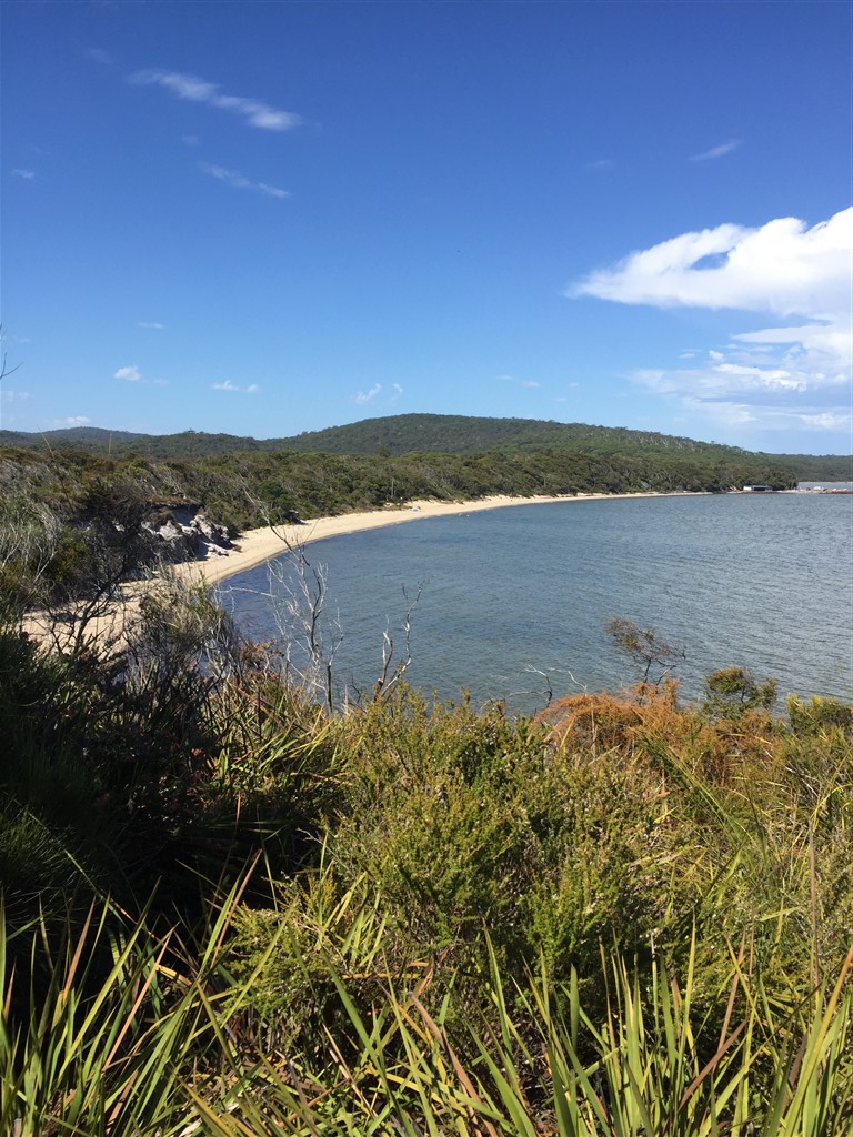
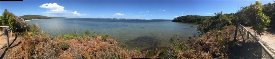
Well what a difference 2 days and 3,856Km (or 2,396 miles) can make!

The blue skies and sun in Perth have been replaced by the rain and clouds of Katoomba. Katoomba is in the heart of the Blue Mountains which are 110Km west of Sydney. I checked into the Katoomba Mountain Lodge – a comfortable, but dated, hostel (with original Bakelite electrical fittings).

With the cloud so low and visibility at zero, I decided to start with the town rather than the mountains.

IMG_0014

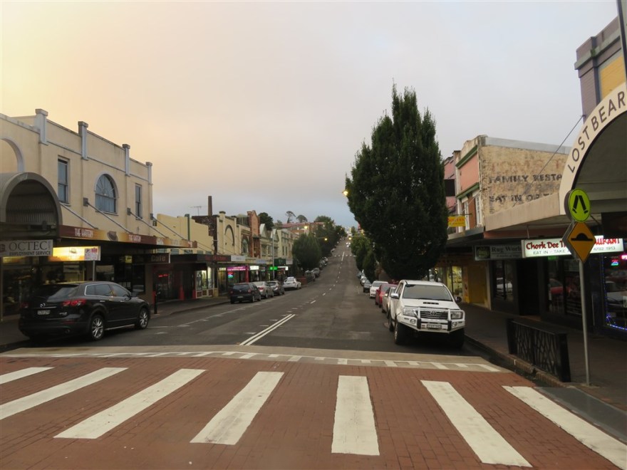
Much of the town was built in the early 1900s and some of these buildings still remain. The Paragon Restaurant just celebrated its centenary last year and is still open for business.

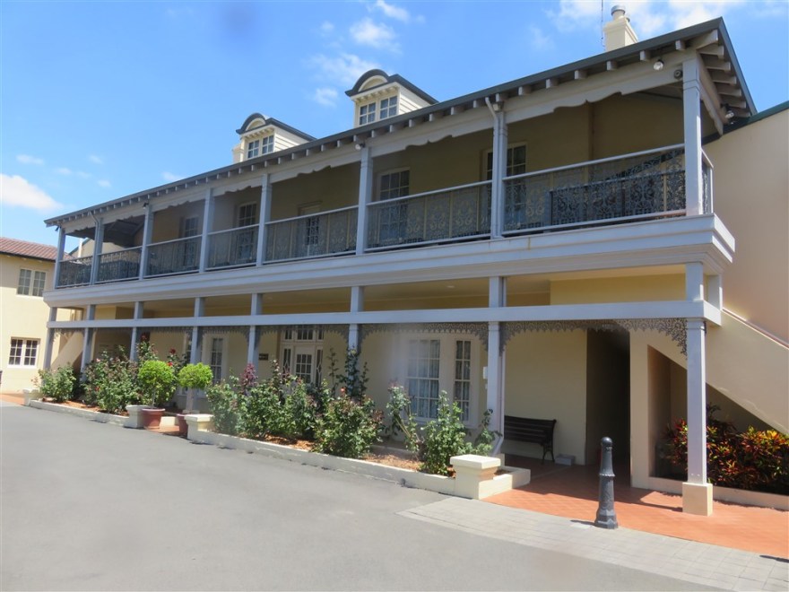
The Carrington Hotel dates back even further. It opened in 1883 to cater for the more wealthy visitors to the Blue Mountains.

IMG_0446

Over the years it changed hands and was extended until the Blue Mountains popularity waned in the 1970s. It struggled on for a few years but closed in 1985 and developers threatened to demolish it. However, it was rescued and restored – reopening in 1998.

A building of interest for different reasons is the Yellow Deli. The café serves food grown on its farm and is owned by the twelve tribes – a confederation of twelve self governing Christian communities. (twelvetribes.org) Their food was excellent and I was strangely attracted to the “Lord of the Rings” architecture. They run the café from Sunday to Friday and close on Saturday to host an open house at their local communal home. They invited me to give up all my worldly goods and join them – I politely declined.

They have recently acquired a property in Honiton, Devon, UK – The Common Loaf Bakery and Tearoom (commonloaf.com) This will be much more convenient if I do see the light and decide to join their community. It is also very close to the Broom family roots in Farway where my Great Grandfather was born.

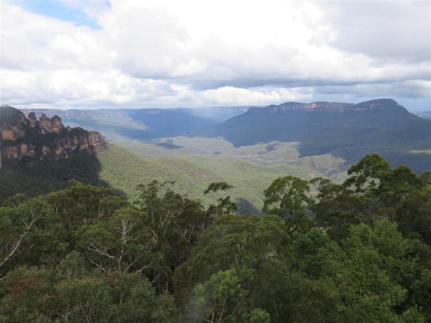
On my second day the sun came out and I was able to head out of town and get my first view of the famous Blue Mountains.

IMG_0044

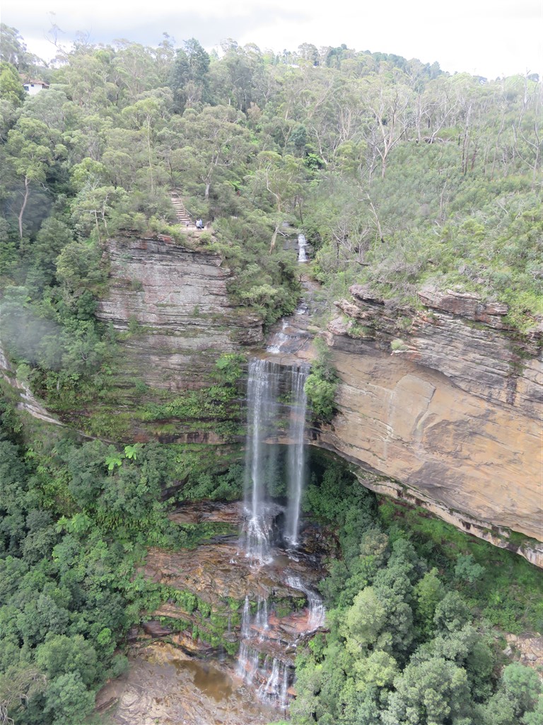
I started with the Katoomba Falls. I walked down to the falls and was able take these pictures along the way. The second picture is taken looking down over the falls.

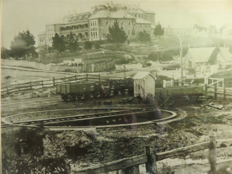
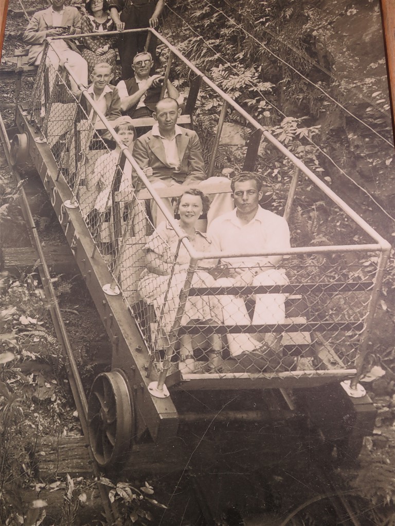
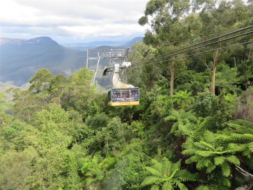
I then headed for Scenic World which sits on the site of a disused coal mine. It is a bit of a tourist trap but offers one of the few options to get down to the valley floor. The mine went out of business in the 19th century but almost immediately they started using a modified mine cart to take tourists down to the valley floor.

IMG_0024

Today they use a slightly newer train to take you down on the world’s steepest railway. The train drops 310m through the natural tunnel used by the mine trains.

Once down in the rainforest, you can follow 2.4 km of walkways around the old mines and forest.

At the end of the walkway you can take a cable car back up.

IMG_0045

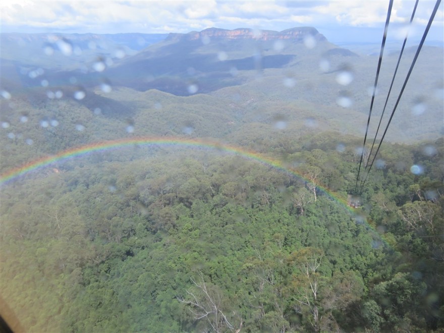
On the way up the weather started to change which did result in a nice rainbow.

IMG_0042

The final “experience” is the Skyway which takes you across the valley to the national park.

IMG_0054

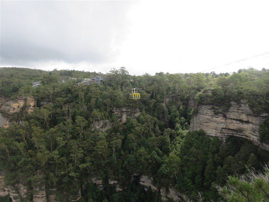
It gives you great views of the Katoomba Falls on the way over.

IMG_0048

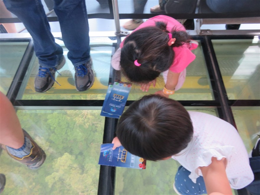
For those not scared of heights, it has a glass floor as well.

IMG_0060

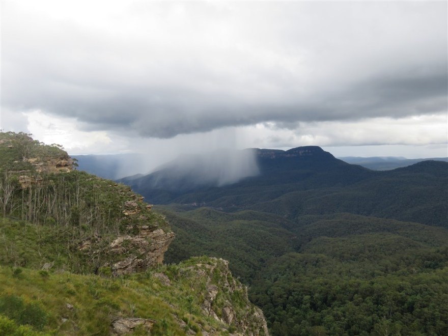
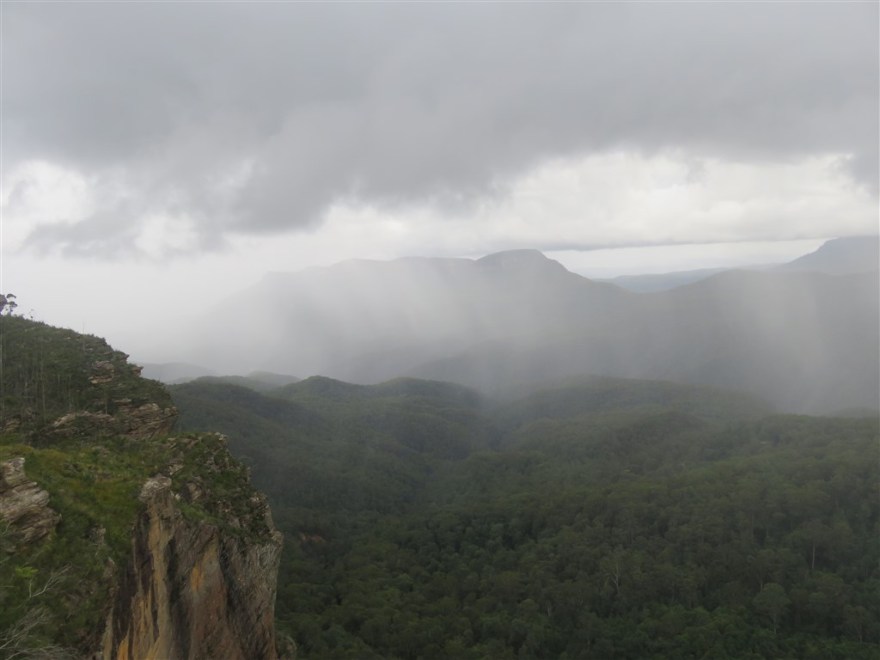
As I was finishing my visit, the weather started to change and you could see the rain coming across the valley.

IMG_0052

IMG_0057

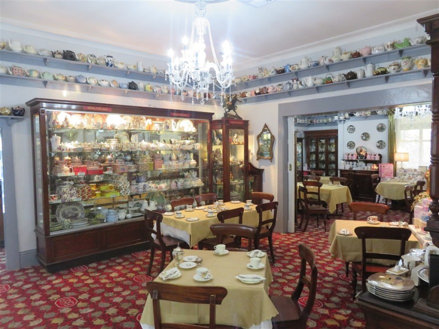
With the weather turning bad again, I decided to visit the nearby village of Leura. It is smaller than Katoomba but the shops and cafes are more up market. If you are looking for something a bit more naff then there is always the Teapot Museum.

IMG_0080

However, my favourite was the Everglades House and Garden. (www.nationaltrust.org.au/places/everglades-house-gardens/) It is managed by the Australian National Trust and retains the original garden designs from the 1930’s. It has a stage in the garden which has the entrance from an old bank in Sydney at the back. I did take more pictures but they were not worth publishing due to the poor weather.

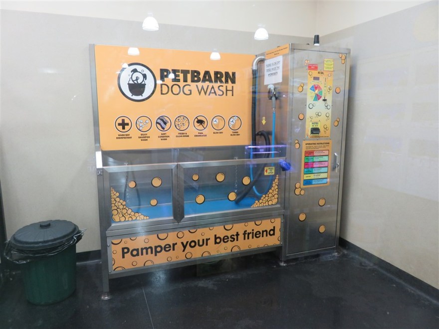
I enjoyed my stay in Katoomba, despite the weather. Another place worth mentioning is the Cultural Centre which houses an excellent library, a café and an exhibition space. I spent quite a bit of time here catching up with my blog. Finally, if you visit with a dog then you may be interested in the automated dog wash facility.

IMG_0068

I caught the early train back to Sydney on 5th March in order to make the lunchtime flight to Brisbane.

Perth

I arrived back in Perth on 24th February. I came back a day earlier than originally planned as I had been give a ticket for A O Lang Pho – a production by Nouveau Cirque du Vietnam which was part of the Perth International Arts Festival. It was at the Regal Theatre, a lovely old theatre in Subiaco.

IMG_0407

It is circus show, of the same quality as Cirque du Soleil, but very different. It has been very successful and is touring globally. If you gate a chance to see it, I strongly recommend you do. I have borrowed the publicity shot below.

AOLangPho

The following day I met up with Stephen and Mel Lupi (who I hadn’t seen since Stephen emigrated in 2003) and their family. I stayed with them for the rest of my time in Perth. They were very generous hosts and I hope to be able to do the same for them when they visit the UK next year.

Perth is a very modern city with on the banks of the Swan River.

Located on a hill above the city is Kings Park. It is one if the largest inner city parks in the world – even larger than Central Park in New York. It has great views over the city.

IMG_0408

The city itself is very modern but it retains some of the older government buildings, such as the old Treasury Building (Now restaurants and a boutique hotel),

the Town Hall,

IMG_0403

and the Supreme Court.

IMG_0399

Some of the older buildings have also been retained in the shopping district.

Unfortunately, there have been some additions that are not quite so classy such as London Court – the mock Tudor shopping arcade.

IMG_0404

Perth has one of the two His Majesty’s Theatres. The other is in Aberdeen, Scotland. (There are many more Her Majesty’s Theatres). Now finally listed as a state heritage icon it is the home to the West Australian Ballet and Opera. You can get a personal tour around it for $2 AUD.

IMG_0428

When it opened in 1904 it was named after King Edward VII.

His Majesty's Theatre PERTH THEATRE TRUST

The Perth water front is currently going through a major regeneration. One of the new buildings is the Bell Tower which houses a large collection of bells, including those from St Martins in the Fields, London.

IMG_0397

Stephen and I drove  out to Freemantle on the coast and visited the Western Australia Ship Wrecks museum. It explains how Western Australia was discovered by the Dutch spice ships over shooting Indonesia and wrecking off the West Australian coast.

The following day I took a trip to Rottnest Island which is 18km off the Freemantle Coast. The island is best known for its population of Quokkas.

They are only found on a few islands (predominantly Rottnest) having been predated by Foxes, Cats and Dogs on the mainland. The island also has many lovely bays and beaches.

During my visit, I also managed to fit in the Claisebrook Cove Parkrun. Another very hot 8am start.
Claisebrook Cove Parkrun_renamed_11156

I will remember Perth for my visit with the Lupi family and the amazing weather. On the 28th February I departed for the east coast of Australia.

IMG_0908

The return to Perth via Katanning

Apologies in advance, this is going to be quite a farming related entry.

Albany was as far south as I had planned to go on this trip and I now needed to make the 418Km trip back to Perth. I didn’t fancy driving it all in one day so I chose a random B&B about half way to break the journey – Woodchester Bed & Breakfast (No web page, Tel: +61 8 9821 7007 only)

IMG_0392

I set off from Albany north west on the Albany Highway and found the drive rather monotonous in heavy traffic. However, after about 40 mins I had to turn off onto the Great Southern Highway to get to Katanning where the B&B was located. This route was much more interesting going through farming country and little towns like Tambellup.

Finally I reached Katanning and found the B&B which was run by Rosemary McFarland. She explained that the town had originally grown around the success of Frederick Henry Piesse who had started with a portable store following the progress of the great southern railway and then decided to settle permanently when he reached Katanning in the 1880s. He built up a successful farming business, including the local flour mill which brought employment and prosperity to the area. He built the Piesse Mansion at the top of the town.

IMG_0391

It is no longer privately owned and is now used as conference centre by the local Baptist church.

After a very comfortable night in the B&B, and good breakfast, Eric McFarland explained to me about the scale of the farming business in the region. The opening of the flour mill resulted in the growth of wheat production in the area. Many of the farms in the area are now over 10,000 acres and the railway is now used exclusively for transporting wheat to Albany. I drove past several agricultural equipment dealers in the town and was amazed at the amount stock they had.

IMG_0394
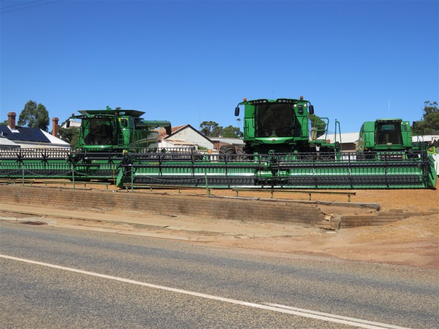
A New Holland dealer further down the road had 8 new machines in his yard.

In addition to arable farming, sheep farming is big as well. Katanning has the largest sheep sales yard in the southern hemisphere. It sold over 1.5 million sheep last year and has a capacity of 26,000 sheep per sale. Sometimes they have to have more than one sale a week to meet demand.

60% of the sheep sold go for slaughter and the local market for the meat is the Muslim countries near Western Australia. Many Muslims from the Cocos (Keeling) Islands and Christmas Island (collectively known as the Australian Indian Ocean Territories) moved to the town in the 1970s to work in the Halal abattoirs. They have stayed and built a sizable community. In 1980 they built a Mosque in the town.

IMG_0393

I also found that the town has a very nice swimming pool. (I didn’t join the OAP fitness class)

IMG_0905

I departed from Katanning on 24th February  for the final part of the drive back to Perth. Rather than take the faster route up the Albany Highway, I continued following the railway up the Great Southern Highway and passed through several more farming towns – Wagin, Narrogin and Brookton.

Albany

I arrived in Albany, my furthest point south on this trip, on 20th February. I booked into a hostel called 1849 Backpackers which differentiated itself on having a stage and selection of musical instruments (which luckily neither I or any of my fellow residents took advantage of during my stay) and offering unlimited pancakes for breakfast (which I did take advantage of).

Albany is the oldest permanently settled town in Western Australia, predating both Perth and Freemantle. Having been very lucky with the weather on my way south, this changed in Albany. This wasn’t a big issue as my intention was to focus on the history of the town rather than the geography. The changeable weather can be seen in the photography.

IMG_0900

Albany is probably most well known in Australia as the departure point for many of the ANZAC (Australian and New Zealand Army Corps) convoys to Egypt and Turkey – the first convoy leaving on 1st November 1914. (Others left from Freemantle) To mark the centenary, the National ANZAC Centre was opened in Albany in 2014.

IMG_0353

Located on the side of Mount Adelaide, looking out over King George Sound, it is one of the most impressive museums I have ever visited. It tells the story of the thousands of men and horses that left from Albany to fight in World War I. Over a third of the men, and all but one of the horses, would not return.

The centre is located in the grounds of the Princess Royal Fort which was active from 1893 until the early 1970s. In addition to the centre itself, there are many exhibits in the grounds of the Fortress – including the restored Victorian buildings and the Convoy Walk, which references every ship that left Albany.

Another important part of Albany’s history was the whaling station that was in operation from 1952 until 1978.

IMG_0874

It is now a museum that describes the history of the local whaling industry and the process of extracting the oil in pretty explicit and gory detail. The station had three ships and a spotter plane that caught over 1,000 whales per year.

IMG_0873

Once caught and towed to the whaling station, a team of Flencers would cut up each whale into small enough pieces to put through holes in the deck that led  to the boilers. The oil was used to make soap, margarine, burn in oil lamps and automatic transmission fluid for cars.

IMG_0872

Today Albany is primarily a tourist destination, a port and a regional support centre for the surrounding agriculture, forestry and mining industries. Many of the original buildings have been restored.

My personal favourite was the London Hotel.

The port is continually busy with train loads of wood chips and road trains of corn arriving every 24 hours a day.

Along the coast of the Southern Ocean there are some popular visitor spots on the rocky coast such as the Gap – a natural channel that has been formed in the granite with an overhanging viewing platform.

IMG_0892

IMG_0895
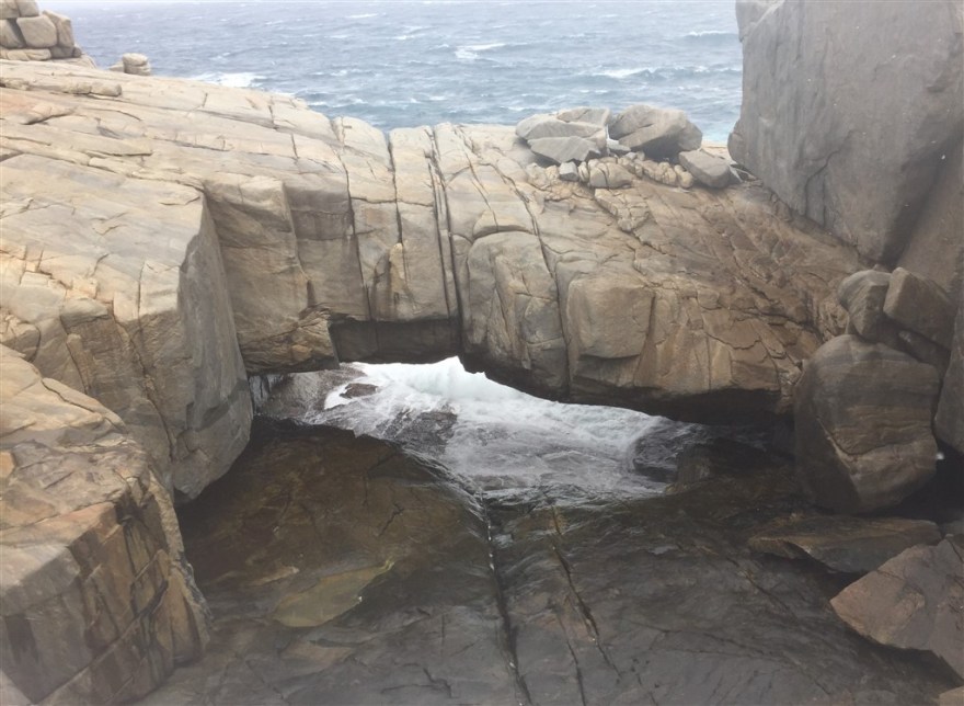
And the Natural Bridge. Both best viewed on windy days!

IMG_0883

One thing that has impressed me with all of the places that I have visited in Western Australia has been the impressive public facilities (all funded by the recent mining boom).  Albany, like many of the other larger coastal towns, has a multi million dollar entertainment centre. I went to see a concert in the state of the art, 1,000+ seat theatre/concert hall.

IMG_0376

Having spent 3 nights in Albany, I set off north (back to Perth) on 23rd February.

IMG_0348

Walpole

After my two detours, I finally arrived in Walpole late on 18th February. Just in time for a great sunset. I stayed at the Walpole Lodge Hostel.

img_0344

Fellow travellers at the hostel recommended I take the WOW Wilderness EcoCruise in the Nornalup Inlets Marine Park. (www.wowwilderness.com.au). We set off from the Walpole jetty and crossed to the far side of the inlets.

img_0322

On the way over Gary, the skipper, told us several stories about Walpole including; how the original inlet tours were started by a French lawyer (Pierre Bellanger) over a century ago; how Walpole was the preferred location for senior allied troops to take their R&R breaks during the 2nd world war; and most incredulously how some of Leo Tolstoy’s papers made their way to Walpole. Once moored on the far side of the inlets, we made our way over the dunes to the southern ocean beach beyond.

img_0315

The beach was deserted..

img_0316

except for an illegal commercial shark fishing boat (all commercial fishing is banned in the marine park). Some of the group with better cameras than mine tried to use their tele photo lens to identify the boat.

img_0319

After the trip to the beach our skipper demonstrated his diving skills.

img_0325

The following day I set off for the Valley of the Giants tree top walk in the Walpole-Nornalup National Park (parks.dpaw.wa.gov.au/site/tree-top-walk).

The walk takes you 40m up in the canopy on specially constructed walkways that are designed to gently sway in the wind to give you the feeling of the trees swaying – a feature to far for me. Although not generally afraid of heights, I was very glad to return to ground level.

You can also walk around the forest to see some of the Red Tingle trees that are now only found in this part of Australia. They are the 3rd highest tree in the world. They were too tall to get in one picture so I focused on their trunks, many of which have had their centres destroyed by rot or fire.

Glad to be back at ground level, I spent the rest of the day on the beach at Walpole.

img_0871

I departed from Walpole on 20th February and set off for Albany.

img_0868


Pemberton

After my quick visit to Busselton, I set off to Walpole via Pemberton as I wanted to ride the old tram there and was also looking to take a more scenic route south. It turned out to be my favourite drive in Western Australia. After leaving Busselton, you enter into big farming country.

img_0278

img_0279

Many individual fields have more cattle than we ever had on our whole farm.

img_0280

As you get nearer Pemberton, the forests begin.

img_0281

img_0282

In this part of the country many of the roads are dirt tracks.

img_0277

The Pemberton Tramway is tourist railway that commenced operations in 1995. It is based at the old Pemberton railway yard. The railway was built to supply the Pemberton Saw Mill with timber to produce sleepers for the Trans-Australian Railway. It continued to be used to haul timber right up until last year when the saw mill finally closed. The mill had been operating 24 hours a day continuously since it was built in 1913. Pemberton is now primarily a tourist town.

The trams were built in the 1980’s specifically to carry tourists.

The trams travel 10km out to Warren River Bridge and back again.

img_0300

The trams stop at the Warren River Cascades on the way out.

img_0297

After this interesting detour, I finally set off for Walpole.


Busselton

I took a detour to Busselton on my way from Margaret River to Walpole to join its Saturday morning Parkrun. The town was named after the Bussel family who relocated their in 1834 to take advantage of the superior farmland in the area.

img_0276

Having chickened out of the Bunbury Parkrun the previous week (as it was raining) I made a special effort to detour north for the Geographe Bay Parkrun (www.parkrun.com.au/geographebay/). It is a straight out and back course along the bay starting near the Busselton Jetty. Although its started early at 8am, it was already pretty hot – nearly 30’C. I was happy with my time of just under 33min as it was my first Parkrun since last June. I hope to get a few more Parkruns in later on this trip.

Busselton is best known for its jetty. The initial wooden structure, on which building commenced in 1853, was only 176m long. It was built so that timber could be loaded onto ships in the shallow Geographe Bay. As ships got bigger, the jetty kept getting extending until the final extension in the 1960s took it 1.8km in length. The last commercial ship visited the jetty in 1971. It then fell into disrepair. Fire, cyclones and several failed restoration attempts meant that it was not opened to the public again until 2001.

At the end of the jetty is a underwater observatory that descends 8m below sea level.

After my quick visit to Busselton, I set off on another detour to Pendleton.

Margaret River

I arrived in Margaret River on 15th February and booked into The Quality Inn (same price as the local hostels). It was an above average motel with very colourful and loud birds outside my room.

Margaret River itself is an unremarkable small town. However, it has a lot of interesting places nearby. About 35km south, just outside the town of Augusta, is the Cape Leeuwin Lighthouse. It is located on a headland that is the most south westerly point on the Australian mainland.

leeuwin

It is still a working lighthouse but is it now fully automated. Between 1895 and 1982 it was manually operated by a team of 3 lighthouse keepers who lived in the cottages on site. The light was rotated by a clockwork mechanism which required winding everyday. The light was provided by a burner that required 35 litres of kerosene a day. This had to be manually brought up the 186 steps to the top of the lighthouse. The keepers avoided having to do all the work by getting the regular flow of visitors to carry a can in return for a view out of the top. Today it is powered by a couple of halogen bulbs that are due to be upgraded to LED equivalents next month.

Cape Leeuwin is also the point where the Southern Ocean meets the Indian Ocean and there is a point where you can see the waves from both oceans meeting. Apologies my photography skills were not up to capturing this detail.

img_0218

The town of Margaret River is in land. Margaret River itself joins the Indian ocean at Prevelly – about 10km due west.

img_0263

It is a popular surfing location. I’ve never got into surfing myself. It seems to involve a lot of waiting around doing nothing.

Prevelly also has several public sculptures, including the lady with green pubes.

img_0250

Margaret River is probably best known for its vineyards, there are over 140 in the region. You could spend all of your time touring the vineyards and sampling their products. I only visited a few as couldn’t drink as I was driving. My favourite was Cape Mentelle.  (www.capementelle.com.au)

The vineyard was established in 1970 by the Hohnen brothers and was one of the first in the region. Despite the challenges of importing delicate French wine making equipment (most of the roads were still dirt) the vineyard was successful. Its success was confirmed when it won the Jimmy Watson Memorial Trophy (Australia’s most prestigious wine award) in 1983 and 1984. The original founders have now moved on (David Hohnen went on to establish the Cloudy Bay vineyard in New Zealand in 1985). It is now the smallest vineyard in the Moet Hennessey Louis Vuitton group and many of the staff are French.

When I visited in mid February, they were preparing to start the grape harvest the following week. Margaret River is lucky in that its vines have less vulnerabilities than other vineyards, but it does have one unique problem. The ripe grapes are a favourite of the Silvereye bird that migrates up from Tasmania. Up until recently there was little that could be done to stop this and the vineyards had to put up with this significant loss every year. In recent years technological innovation has made it cost effective to cover the vines with nets. A massive task normally undertaken a month or less before harvest (Bird netting in Margaret River)

img_0245

Although not usually a big red wine fan, I do like their Cabernet Sauvignon. I also enjoyed their open air cinema.

img_0226

My final night in Margaret River coincided with their regular night market – food vendors, live music in a local park on a warm evening.

img_0271

After an enjoyable 3 nights in Margaret River I headed north to take in a couple of things I missed on the way down – Busselton and Pendleton.

Bunbury

I arrived in Australia at Perth Airport early on 9th February and picked up a rental car. My plan was to head south along the coast and then visit Perth on my return. The previous week I had been told that I needed to submit a US tax return for last year, something I wasn’t expecting. As this would take a couple of days, I looked for somewhere “cost effective” to get this sorted before getting heading off into wine country. I chose Bunbury about 175km south of Perth and checked into The Clifton & Grittleton Lodge. (I convinced myself I needed to stay in a hotel to have a good internet connection to do my online tax return – hostels tend to have notoriously flaky internet access)

img_0172

The port city of Bunbury is the third largest city in Western Australia with a population of 75,000. It is the birth place of several well known Australian Football League players and Australian daytime TV presenters – other than that, there is not much more to say about the place.

When I arrived it was raining and very grey. (Great weather for tax returns)

img_0147

One good thing about Bunbury was that it had a fringe festival on while I was there. It wasn’t quite Edinburgh but it gave me something to do in the evenings and I saw some good live music. My favourite was Timothy Nelson.

img_0117

Needing a bit of a break from tax returns I set off for drive inland and found myself in Collie, an old mining town.

The Wellington dam was listed as one of the main visitor attractions!

The Collie river was very nice, even on a grey day.

However, the highlight of the trip was discovering Gnomesville, in Wellington Mill, on my way home. It started out in 1995 when gnomes were placed at a road intersection as a protest against the construction of a roundabout and visitors have added to it ever since. (The roundabout got built)

I also needed to find out if my dysentery had been cured. Registering for a Medicare number (UK and Australia have reciprocal free healthcare arrangements), getting a doctor’s appointment and waiting for test results meant I had to extend my stay by another 3 days. However, the sun came out (and the tests confirmed the dysentery was cured).

I visited the Dolphin Discovery Centre where the dolphins are very friendly and regularly come in to check out the humans.

img_0149

I finally started running again and took to running along the beach at sunset.

img_0179

Having spent nearly a week in Bunbury, I became quite fond of it. When the weather improved it almost reminded me of Miami.

img_0190

I finally departed on 15th February and headed off for Margaret River.

Seminyak

I arrived in Seminyak by Uber from Ubud on 2nd February. Having enjoyed my afternoon tea at Mandapa, I decided I needed to upgrade my accommodation for a few days. I found a great deal at the Double Six Luxury Hotel in Seminyak. The hotel had only just opened and had highly discounted rates during the off season. I had a nice room with a balcony.

There was a lovely pool and the weather was great for most of time (it just rained for one afternoon during my 3 day stay)

Unfortunately, I wasn’t that impressed with the rest of Seminyak. It is a mixed tourist/residential area on the west coast of Bali. It is marketed as an upmarket area, popular with expatriates, with some of the highest land and accommodation prices in Bali. However, I just found a black sand beach and lots of tacky bars and shops.

imga0025

Despite the grim exterior, the hotel was excellent and was a great place to lounge about and do nothing for a few days. I read a couple of books, binge watched some illegally downloaded episodes of Father Brown, got this blog setup, started running again in the hotel gym and spent time by the pool.

I flew out of Bali, back to Jakarta, on 6th February. I then spent 2 more days in Jakarta before departing for Australia.